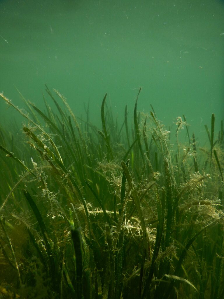
Eelgrass is an ecologically and economically valuable marine flowering plant that provides habitat to a variety of marine organisms, serves as a food source for others, and helps to stabilize sediments and improve water quality.
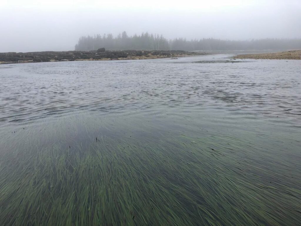
Based on mapping carried out by the Department of Marine Resources, there were 3,174 acres of eelgrass in Frenchman Bay in 1996. In 2008, mapping revealed 1,076 acres; only 34% of what was there in 1996. In 2010, 35 acres of eelgrass were lost from the Jordan River. By the spring of 2013 it was evident that there was an additional significant loss of eelgrass in the bay. Eelgrass in restoration areas at Hadley Point, Berry Cove, and around Thomas Island disappeared. Taunton Bay eelgrass disappeared as well. As of August 2013, there was an estimated 75-183 acres of eelgrass left in Frenchman Bay.
Goals and Strategies
- By 2030, restore eelgrass to 1996 levels at Hadley Point, Thomas Island, part of Berry Cove, and part of the Jordan River.
- In 2013 efforts were made to maintain good water quality (3-4 m transparency) and keep it at that level. (Water quality is essential to eelgrass health and survival and water transparency is necessary to ensure that enough sunlight reaches the eelgrass for photosynthesis.)
Strategies underway for Goal 1:
Eelgrass restoration
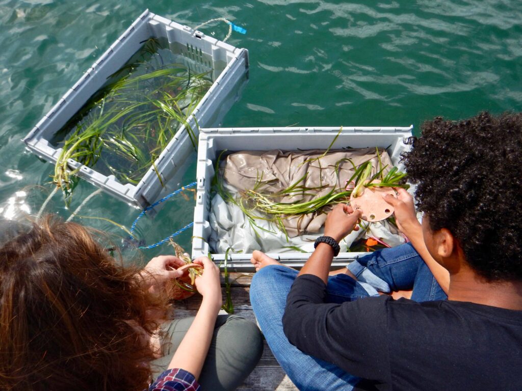
Mount Desert Island Biological Laboratory (MDIBL) has been carrying out eelgrass restoration efforts in Frenchman Bay since 2007. These efforts will continue in the priority areas with continued support from volunteers, interns, AmeriCorps members, and the expanding network of Frenchman Bay Partners. Here you can view a synthesis of the ongoing eelgrass surveillance and restoration from the Community Lab.
Communication and collaboration amongst user groups
Successful eelgrass restoration depends, in part, on the effective communication of restoration objectives and activities to different bay users. In January 2013, FBP representatives from MDIBL met with local mussel harvesters to collaborate on the designation of eelgrass restoration areas and transplant “donor” sites. Live mapping carried out by the FBP representative from Maine Coast Heritage Trust allowed for changes to be made to the proposed restoration areas according to the consensus reached in the room. These conversations were also facilitated by the FBP representative from the Margaret Chase Smith Policy Center, University of Maine, Orono. By the end of this meeting, an informal agreement was made, recognizing the agreed upon restoration areas and donor sites as no-harvest zones, which will reduce the risk of damage caused by harvesting equipment to the eelgrass and its rhizomal, or root, structures.
Eelgrass Research at the Community Lab
Use the sliding scale below to explore the presence of eelgrass in Frenchman Bay. This map is a part of a complete ESRI Story Map about Eelgrass created by Ashley Taylor as a part of her work with the Community Lab in 2021.
Eelgrass Resources
Here are a number of resources that illustrate the density of eelgrass at the various study sites:
- 2008 to 2018 Eelgrass Map Book
- 1997 to 2008 Eelgrass Map Book
- 2017 Summary of Eelgrass Density Data around Mt. Desert Island
- 2018 Summary of Eelgrass Density Data around Mt. Desert Island
Dr. Jane Disney and fellow researchers published a chapter highlighting efforts to restore eelgrass between 2007 and 2017: Disney, J., Fox, E., Farrell, A., LeDuc, C., & Bailey, D. (2017). Engagement in Marine Conservation through Citizen Science. Citizen Science For Coastal And Marine Conservation, 153-177. doi: 10.4324/9781315638966-8
to learn more about the Eelgrass Project contact Dr. Jane Disney at jdisney@mdibl.org